Cartogram
), in which their geographic size is altered to be directly proportional to a selected variable, such as travel time, population, or gross national income.
[3] The earliest known cartogram was published in 1876 by French statistician and geographer Pierre Émile Levasseur, who created a series of maps that represented the countries of Europe as squares, sized according to a variable and arranged in their general geographical position (with separate maps scaled by area, population, religious adherents, and national budget).
He produced them as teaching aids, immediately recognizing the intuitive power of size as a visual variable: "It is impossible that the child is not struck by the importance of the trade of Western Europe in relation to that of Eastern Europe, that he does not notice how much England, which has a small territory but outweighs other nations by its wealth and especially by its navy, how much on the contrary Russia which, by its area and its population occupies the first rank, is still left behind by other nations in the commerce and navigation."
The subsequent expansion of densely populated areas around Berlin, Hamburg, and Saxony was intended to visualize the controversial tendency of the mainly urban Social Democrats to win the popular vote, while the mainly rural Zentrum won more seats (thus presaging the modern popularity of cartograms for showing the same tendencies in recent elections in the United States).
[7][8] Most were rather crudely drawn compared to Haack and Weichel, with the exception of the "rectangular statistical cartograms" by the American master cartographer Erwin Raisz, who claimed to have invented the technique.
[1] Since the early days of the academic study of cartograms, they have been compared to map projections in many ways, in that both methods transform (and thus distort) space itself.
As with map projections, the tradeoffs inherent in cartograms have led to a wide variety of strategies, including manual methods and dozens of computer algorithms that produce very different results from the same source data.
Other strictly positive ratio variables can also be used, such as GDP per capita or Birth rate, but these can sometimes produce misleading results because of the natural tendency to interpret size as total amount.
Recently, more thorough taxonomies by Nusrat and Kobourov, Markowska, and others have built on this basic framework in an attempt to capture the variety in approaches that have been proposed and in the appearances of the results.
This approach has its roots in the early 20th Century cartograms of Haack and Weichel and others, although these were rarely as mathematically precise as current computerized versions.
The variety of approaches that have been proposed include cellular automata, quadtree partitions, cartographic generalization, medial axes, spring-like forces, and simulations of inflation and deflation.
This is perhaps the simplest method for constructing a cartogram, in which each district is simply reduced or enlarged in size according to the variable without altering its shape at all.
Typically, this method is used when it is more important for readers to ascertain the overall geographic pattern than to identify particular districts; if identification is needed, the individual geometric shapes are often labeled.
In this approach (also called block or regular cartograms), each shape is not just scaled or warped, but is reconstructed from a discrete tessellation of space, usually into squares or hexagons.
This has made them very popular for visualizing the United States Electoral College that determines the election of the president, appearing on television coverage and numerous vote-tracking websites.
[27] Several examples of block cartograms were published during the 2016 U.S. presidential election season by The Washington Post,[28] the FiveThirtyEight blog,[29] and the Wall Street Journal,[30] among others.
The spatial distortion allows the map reader to easily visualize intangible concepts such as travel time and connectivity on a network.
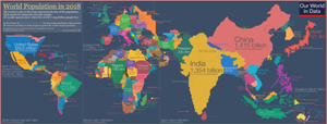
For example, WorldMapper has used this technique to map topics relating to global social issues, such as poverty or malnutrition; a cartogram based on total population is combined with a choropleth of a socioeconomic variable, giving readers a clear visualization of the number of people living in underprivileged conditions.


Net contributors