Geography of Equatorial Guinea
It is shaped like a boot, with two large volcanic formations separated by a valley that bisects the island at its narrowest point.
The 195-kilometer (121 mi) coastline is steep and rugged in the south but lower and more accessible in the north, with excellent harbors at Malabo and Luba, and several scenic beaches between those towns.
The coastal plain gives way to a succession of valleys separated by low hills and spurs of the Crystal Mountains.
The Rio Benito (Mbini) which divides Río Muni in half, is unnavigable except for a 20-kilometer stretch at its estuary.
Most of the estimated 1,900 inhabitants are fisherman specializing in traditional, smallscale tuna fishing and whaling.
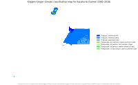
Total renewable water resources: 26 km3 (2011) Natural hazards: violent windstorms, flash floods Environment — current issues: tap water is not potable; deforestation Environment — international agreements: party to: Biodiversity, Desertification, Endangered Species, Hazardous Wastes, Law of the Sea, Marine Dumping, Ozone Layer Protection, Ship Pollution, Wetlands Geography note: insular and continental regions rather widely separated The climate of both the continental region and the islands is typically equatorial, with high temperatures, heavy rainfall, and much cloud cover most of the year.
In Bata the rainiest months are September, October, and November, with rainfall averaging more than 94 in (2,388 mm) a year.
Extreme rainfall occurs in the south, with rain brought by monsoon winds amounting to about 450 in (11,430 mm) a year around San Antonio de Ureca.