Geography of Libya
Although the oil discoveries of the 1960s have brought immense wealth, at the time of its independence it was an extremely poor desert state whose only important physical asset appeared to be its strategic location at the midpoint of Africa's northern rim.
Libya lay within easy reach of the major European nations and linked the Arab countries of North Africa with those of the Middle East, facts that throughout history had made its urban centres bustling crossroads rather than isolated backwaters without external social influences.
There are several highlands but no true mountain ranges except in the largely empty southern desert near the Chadian border, where the Tibesti Massif rises to over 2,200 metres.
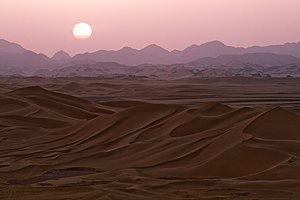
Still farther south a pastoral zone of sparse grassland gives way to the vast Sahara Desert, a barren wasteland of rocky plateaus and sand.
About 120 km inland the plain terminates in an escarpment that rises to form the Nafusa Mountains, with elevations of up to 1,000 metres, which is the northern edge of the Tripolitanian Plateau.
Behind the Marj Plain, the terrain rises abruptly to form Jabal al Akhdar (Green Mountain), so called because of its leafy cover of pine, juniper, cypress, and wild olive.
The separateness of the regions is much more than simply geographical and political, for they have evolved largely as different socioeconomic entities – each with a culture, social structure, and values different from the others.
In the 1980s their degrees of separation were still sufficiently pronounced to represent a significant obstacle to efforts toward achieving a fully unified Libya.
Deficiency in rainfall is reflected in an absence of permanent rivers or streams, and the approximately twenty perennial lakes are brackish or salty.
In 1987 these circumstances severely limited the country's agricultural potential as a basis for the sound and varied economy Gaddafi sought to establish.
The wadis are heavily settled because soil in their bottoms is often suitable for agriculture, and the high water table in their vicinity makes them logical locations for digging wells.
It is intended to tap the tremendous aquifers of the Kufra, Sarir, and Sabha oases and to carry the resulting water to the Mediterranean coast for use in irrigation and industrial projects.
Terrain: mostly barren, flat to undulating plains, plateaus, depressions Elevation extremes: lowest point: Sabkhat Ghuzayyil -47 m highest point: Bikku Bitti 2,267 m[15][16] Natural resources: petroleum, natural gas, gypsum Land use: arable land: 0.99% permanent crops: 0.19% other: 98.82% (2011) Irrigated land: 4,700 km2 (2003) Total renewable water resources: 0.7 0.7 km3 (0.17 cu mi) (2011) Natural hazards: hot, dry, dust-laden ghibli is a southern wind lasting one to four days in spring and fall; dust storms, sandstorms Environment - current issues: desertification; very limited natural fresh water resources; the Great Manmade River Project, the largest water development scheme in the world, is being built to bring water from large aquifers under the Sahara to coastal cities Environment - international agreements: party to: Biodiversity, Climate Change, Climate Change-Kyoto Protocol Desertification, Endangered Species, Hazardous Wastes, Marine Dumping, Ozone Layer Protection, Ship Pollution, Wetlands signed, but not ratified: Law of the Sea This is a list of the extreme points of Libya, the points that are farther north, south, east or west than any other location.