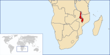
Geography of Malawi
The Zomba and Mulanje mountain peaks rise from the highlands to respective heights of 2,100 and 3,000 metres (7,000 and 10,000 feet).
[2] Malawi's climate is hot in the low-lying areas in the south of the country and temperate in the northern highlands.
In its middle stretch between Chigaru and Chikwawa, the Shire River drops almost 400 m (1,300 ft) through 80 km (50 mi) of gorges, rapids, and cataracts.
In the extreme south, the Shire enters the Zambezi lowlands, and the elevation is only 60–90 m (200–300 ft) above sea level.
Between November and April the temperature is warm with equatorial rains and thunderstorms, with the storms reaching their peak severity in late March.
[1] It is hot and humid from September to April along the lake and in the lower Shire Valley, with average daytime maximum around 27 to 29 °C (80.6 to 84.2 °F).
From June through August, the lake areas and south are comfortably warm, with daytime maxima of around 23 °C (73.4 °F), but the rest of Malawi can be chilly at night, with temperatures ranging from 10–14 °C (50.0–57.2 °F).
High altitude areas such as Mulanje and Nyika are often cold at night (around 6–8 °C or 42.8–46.4 °F) during June and July.
Environment – current issues: Deforestation; land degradation; water pollution from agricultural runoff, sewage, industrial wastes; siltation of spawning grounds endangers fish populations Environment – international agreements: party to: Biodiversity, Climate Change, Climate Change-Kyoto Protocol, Desertification, Endangered Species, Environmental Modification, Hazardous Wastes, Marine Life Conservation, Ozone Layer Protection, Ship Pollution, Wetlands signed, but not ratified: Law of the Sea[11] This is a list of the extreme points of Malawi, the points that are farther north, south, east or west than any other location.