Geography of Pennsylvania
The geography of Pennsylvania varies from sea level marine estuary to mountainous plateau.
The Lehigh River in the state's east and Oil Creek in its west are smaller waterways that played vital roles in Pennsylvania's early industrial development.
Some adherents eschew modern conveniences and use of horse-drawn farming equipment and carriages, while others are virtually indistinguishable from non-Amish or Mennonites.
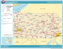
Several factors set Western Pennsylvania apart from the east, including the initial difficulty of access across the mountains, rivers oriented to the Mississippi River drainage system, and complex economics involved in the rise and decline of the American steel industry centered in and around Pittsburgh, the state's second-largest city.
Pennsylvania is bisected in an S-curve, or roughly diagonally, by the barrier ridges of the Appalachian Mountains from southwest to northeast, forcing pre-20th century ground travel most often on or near the ancient Amerindian trails along the higher terrains of the local watersheds with limited penetration and connectivity often only through water gaps.
As rough looking as the first map appears, the valley bottoms throughout the entire central part of the state and parts of lower New York state are connected by the Susquehanna River and its tributaries, which included nearly the entire length of the Pennsylvania Canal System in the 1830s.
The plateau is underlain by sedimentary rocks of Mississippian and Pennsylvanian age, which bear abundant fossils, mineral deposits such as iron, as well as natural gas, coal and petroleum.
In Northeastern Pennsylvania east of Harrisburg on the Susquehanna River, these ridge and valley features contain the richest and most widespread deposits of high energy clean burning anthracite coal in the world—the Coal Region—without which the American Industrial Revolution likely would have been delayed or not possible.
At its furthest extent, it spread as far south as Moraine State Park, about 40 miles (64 km) north of Pittsburgh.
The tidal marsh of Pennsylvania's only saltwater shore has been protected as John Heinz National Wildlife Refuge at Tinicum.