Hurricane Earl (2016)
Heavy rain in Mexico triggered many landslides, several of which proved fatal in the states of Puebla, Hidalgo, and Veracruz; at least 81 people died in the country.
On July 25, 2016, the National Hurricane Center (NHC) began monitoring a tropical wave over the eastern Atlantic along the coast of West Africa.
[1] Early on July 26, a 1010 mbar (hPa; 29.83 inHg) surface low developed along the wave axis (confirmed by scatterometer data and nearby observations);[2] however, this feature was transient and soon dissipated.
[6] The thunderstorms increased on July 30 as the wave began moving through the Lesser Antilles,[7] assisted by above-normal water temperatures and light wind shear.
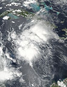
[8] Despite more convective organization and the presence of strong winds, the lack of a surface circulation prevented the system from being classified as a tropical cyclone.
[10] While passing south of the Dominican Republic on August 1, the system became much better organized, producing tropical storm-force winds in its northern periphery.
[13] Early on August 2, the system passed south of Jamaica,[14] and a Hurricane Hunters flight was able to observe a closed circulation.
As a result, the NHC classified the system as Tropical Storm Earl at 16:00 UTC that day, located 215 mi (350 km) south-southeast of Grand Cayman and situated between Jamaica and northeastern Honduras.
[15] Upon its classification, Earl was still moving quickly westward, steered by the strong flow of a ridge located over the southern United States.
[18] The eyewall, visible from the coast of Belize, was closed at times[19] and the peak winds briefly increased to 85 mph (140 km/h).
[21] Moving over the Yucatán Peninsula and across the mountainous terrain of northern Guatemala, Earl quickly weakened; its convection diminished, although its circulation remained well-defined.
[8] In Jamaica, the government activated its National Emergency Center, which advised residents in low-lying areas and near the coast to evacuate.
[13] After Earl formed, the government of Honduras issued a tropical storm warning for its entire northern coastline, from Cape Gracias a Dios westward to the border with Guatemala.
[43] Officials in Mexico opened 750 emergency shelters in Quintana Roo, helping 300 families to evacuate along a river in the southeastern portion of the state.
[33] In Tabasco state, the military activated 1,500 troops for relief work,[44] while along the Bay of Campeche, offshore petroleum companies evacuated their workers.
[52] Along the northern coast near Nagua, the system's strong winds knocked a power line onto a bus, causing a fire that killed six people and injured 12.
[47] The combination of 9–12 in (230–300 mm) in rainfall and a storm surge flooded coastal areas across central and northern Belize, including the cayes.
[61] During the storm, the City Emergency Management Organization, in addition to the Belize Defence Force, responded to over 100 search and rescue requests.
[62] The resulting heavy debris blocked thoroughfares in affected areas,[61] and bridges were damaged in San Ignacio and Calla Creek.
[69] On the offshore San Pedro Town, the storm damaged businesses reliant on tourism, such as docks and scuba shops.
[73] The floods and landslides heavily damaged roads in mountainous and isolated areas of Veracruz and Puebla states,[76] forcing 1,700 families to leave their homes to shelters.
[86] The government focused their initial disaster response on search and rescue missions, medical care, helping storm victims, cleaning debris from roads, and restoring utilities.
[39] The country's Minister of Works sent employees to clear blocked highways,[87] and the government hired residents to help clean the streets from debris.
[92] The Belize government received US$261,073 from the Caribbean Catastrophe Risk Insurance Facility, having first bought an excess rainfall policy in June 2016.
[96] Mexico's Secretary for Social Development provided $3.6 million (MXN, US$190,800) to three communities in Veracruz toward temporary work programs.
[99] In the landslide-struck regions of eastern Mexico, a crew of 600 soldiers and rescue workers searched the mountains for storm victims, with the assistance of sniffer dogs.
[100] Officials sent trucks containing food, water, and oil to the hard-hit town of Huauchinango, enough supplies for 1,800 people for ten days.
[99] The Mexican Red Cross brought ambulances to the isolated community Chicauaxtla, where they helped assess the scope of the storm damage.

Tropical storm (39–73 mph, 63–118 km/h)
Category 1 (74–95 mph, 119–153 km/h)
Category 2 (96–110 mph, 154–177 km/h)
Category 3 (111–129 mph, 178–208 km/h)
Category 4 (130–156 mph, 209–251 km/h)
Category 5 (≥157 mph, ≥252 km/h)
Unknown