Hurricane Norbert (2008)
Strong wind shear initially prevented much development, but the cyclone encountered a more favorable environment as it moved westward.
As the cyclone rounded the western periphery of a subtropical ridge over Mexico, it began an eyewall replacement cycle which led to steady weakening.
In preparation for the cyclone, the NHC issued hurricane warnings for coastal regions of the Baja California Peninsula.
Residents living in low-lying areas and flood-prone regions were advised to evacuate, and beach-goers were warned to stay out of the water.
Though the strongest winds observed were less than hurricane intensity, heavy rainfall as a result of Norbert lead to substantial damage.
The depression was located over an area of warm water temperatures and moderate vertical wind shear, and as such was forecast to intensify gradually.
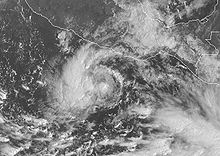
[5] By early on October 5, deep convection developed and organized around the center of the depression, and satellite intensity estimates using the Dvorak technique suggested that the system had tropical storm force-winds; as a result, the NHC upgraded the depression to Tropical Storm Norbert, about 245 mi (395 km) south of Zihuatanejo.
[6] Norbert slowly intensified,[1] and was upgraded to a hurricane on October 6 as very deep atmospheric convection remained stable despite easterly wind shear.
[8] Overnight on October 8, an eye appeared on infrared satellite, indicating that Norbert was intensifying and the storm was upgraded to a major hurricane respectively.
[9] Continuing to rapidly strengthen over warm sea surface temperatures, it reached Category 4 status late on October 8, after intensifying 45 mph (72 km/h) over the previous 24 hours.
The peak intensity of Norbert is uncertain as aircraft-based wind speed observations were lower than estimates via Dvorak Technique.
[1] However, the cloud pattern became less impressive early on October 9, and was thus downgraded into a Category 3 hurricane, with winds of 125 mph (201 km/h) as it moved.
Hurricane watches were issued from Agua Blanca to Cabo San Lucas, and were extended around the Baja California peninsula to La Paz; these same areas were also under tropical storm warnings as well.
[1] On October 10, officials in Baja California declared the municipalities of Loreto, Comondú and La Paz disaster areas in anticipation of severe damage from the hurricane.
[13] The mayor of Los Cabos, Óscar Núñez, strongly advised residents living in sub-par housing and in low-lying areas to prepare to evacuate.
[14] As the storm produced cloudy skies in Baja California, fishermen moved their boats onto the beach in La Paz.
[15] "All precautions are in place ... we have prepared temporary shelters," said Jose Gajón, director of Baja California Sur rescue services.
According to tourism officials, hotel reservations were down 40% in Los Cabos and Lorento Roofs were ripped off buildings and many trees were damaged.
[19] In La Paz, the storm produced violent winds, a few last-minute drivers on streets with fallen trees.
[28] The fishing industry in Sinaloa sustained severe losses, with 200 shrimp boats being destroyed leaving MXN 8 million (2008, US$600,000 ) in damages.
Six power poles were snapped, a steel building was destroyed and blown onto Interstate 40 and three water tanks were severely damaged.

Tropical storm (39–73 mph, 63–118 km/h)
Category 1 (74–95 mph, 119–153 km/h)
Category 2 (96–110 mph, 154–177 km/h)
Category 3 (111–129 mph, 178–208 km/h)
Category 4 (130–156 mph, 209–251 km/h)
Category 5 (≥157 mph, ≥252 km/h)
Unknown