Geography of New Jersey
Finns Point, piers at Penns Grove, New Jersey and Pennsville, and Artificial Island, the tip of a small peninsula[2] at Lower Alloways Creek are connected to Salem County.
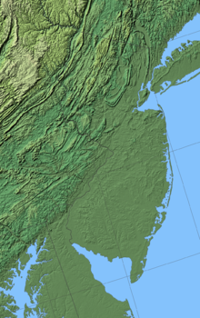
Northwestern and southern New Jersey are also extremely rural due to the mountainous and hilly terrain of the Ridge and Valley region.
New Jersey's longest river located entirely within its borders, the 80-mile (130 km) Passaic, rises in Mendham Township and flows to Newark Bay, serving as a county line along much of that length.
Along with tributaries such as the Pequannock and Ramapo, the combined Passaic/Hackensack watershed covers most of northeastern New Jersey as well as parts of Orange and Rockland counties in New York.
The Musconetcong, New Jersey's longest river that does not drain into the Atlantic directly, flows out of Lake Hopatcong southwest to the Delaware.
At Lake Mohawk near Sparta in Sussex County, the Wallkill, the longest river to rise in New Jersey, begins its 88-mile (142 km) journey to Rondout Creek shortly before that stream flows into the Hudson at Kingston, New York.
The longest in that region, the 51-mile (82 km) Mullica, rises outside Berlin and flows across the Pine Barrens to the Atlantic at Little Egg Harbor.
Other prominent waterbodies in New Jersey include Sunfish Pond in Warren County, the southernmost glacial tarn along the Appalachian Trail.
The highest point in South Jersey is Arneys Mount, a small hill in Burlington County's Springfield Township, at approximately 240 feet (73 m).
Around 250 million years ago, during the Paleozoic and Mesozoic eras, the area that is today New Jersey bordered northern Africa as part of the supercontinent of Pangea.
Numerous abandoned mines dot the region, dating from the 18th and 19th centuries when iron, copper, zinc and other minerals were extracted from the formations.
The glaciated northern half of the province has an abundance of lakes and reservoirs which serve as water supplies for the urban areas to the east.
It lies within the broader region known as the Piedmont, a crescent-shaped area characterized by smooth topography and large volumes of sediments.
Like the Piedmont, the Newark Basin has gentle topography consisting of red bed clastic sediments with occasional igneous rock formations, such as the Palisades Sill and the Watchung basalt flows; these igneous features are responsible for the dramatic elevation changes observed in the region, such as The Palisades and the Watchung Mountains, respectively.
The Monmouth County Park system, for example, includes a number of creeks where students and enthusiasts can gain real field exposure to cretaceous geology and paleontology.
Fertile, loamy soil makes the land ideal for agriculture and is responsible for New Jersey's nickname of the "Garden State".
The lack of fertility makes much of the region unsuitable for agriculture and large areas remain undeveloped.
The sandy Pine Barrens, an area that is agriculturally poor but species rich, occupy the center of the province.
Along the coast, sandy beaches attract a recreation industry, and the offshore barrier islands are popular vacation destinations.