Ordnance Survey
It produces digital map data, online route planning and sharing services and mobile apps, plus many other location-based products for business, government and consumers.
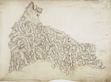
Prince William, Duke of Cumberland realised that the British Army did not have a good map of the Scottish Highlands to locate Jacobite dissenters such as Simon Fraser, 11th Lord Lovat so that they could be put on trial.
[4] In response, King George II charged Watson with making a military survey of the Highlands under the command of the Duke of Cumberland.
The survey was produced at a scale of 1 inch to 1,000 yards (1:36,000)[5] and included "the Duke of Cumberland's Map" (primarily by Watson and Roy), now held in the British Library.
Work was begun in earnest in 1790 under Roy's supervision, when the Board of Ordnance (a predecessor of part of the modern Ministry of Defence) began a national military survey starting with the south coast of England.
Roy's birthplace near Carluke in South Lanarkshire is today marked by a memorial in the form of a large OS trig point.
In 1991, Royal Mail marked the bicentenary by issuing a set of postage stamps featuring maps of the Kentish village of Hamstreet.
[9] During the next 20 years, about a third of England and Wales was mapped at the same scale (see Principal Triangulation of Great Britain) under the direction of William Mudge, as other military matters took precedence.
For instance, Major Thomas Colby, the longest-serving Director General of the Ordnance Survey, walked 586 mi (943 km) in 22 days on a reconnaissance in 1819.
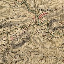
The instructions for their use were: The persons employed on the survey are to endeavour to obtain the correct orthography of the names of places by diligently consulting the best authorities within their reach.
[16][17][18] Colby believed in leading from the front, travelling with his men, helping to build camps and, as each survey session drew to a close, arranging mountain-top parties with enormous plum puddings.
When Colby retired, he recommended William Yolland as his successor, but he was considered too young and the less experienced Lewis Alexander Hall was appointed.
Following a fire at its headquarters at the Tower of London in 1841[28] the Ordnance Survey relocated to a site in Southampton and was in disarray for several years, with arguments about which scales to use.
From 1824, the OS began a 6-inch (1:10,560) survey of Ireland for taxation purposes but found this to be inadequate for urban areas and adopted the five-foot scale (1:1056) for Irish cities and towns.
[40] From 1911 onwards – and mainly between 1911 and 1913 – the Ordnance Survey photo-enlarged many 1:2500 sheets covering built-up areas to 1:1250 (50.688 inches to the mile) for Land Valuation and Inland Revenue purposes: the increased scale was to provide space for annotations.
The new Director General, Major-General Malcolm MacLeod, started the retriangulation of Great Britain, an immense task involving the erection of concrete triangulation pillars ("trig points") on prominent hilltops as infallible positions for theodolites.
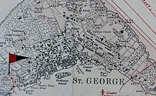
[41][42] Staff were dispersed to other buildings and to temporary accommodation at Chessington and Esher, Surrey, where they produced 1:25000 scale maps of France, Italy, Germany and most of the rest of Europe in preparation for its invasion.
[19] By the late 1990s technological developments had eliminated the need for vast areas for storing maps and for making printing plates by hand.
Although there was a small computer section at the Ordnance Survey in the 1960s, the digitising programme had replaced the need for printing large-scale maps, while computer-to-plate technology (in the form of a single machine) had also rendered the photographic platemaking areas obsolete.
[52] On 10 June 2019 the Department for Business, Energy and Industrial Strategy (BEIS) appointed Steve Blair as the Chief Executive of the Ordnance Survey.
[53][54] The Ordnance Survey supported the launch of the Slow Ways initiative, which encourages users to walk on lesser used paths between UK towns.
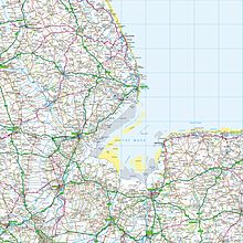
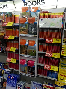
The Ordnance Survey produces a wide variety of different products aimed at business users, such as utility companies and local authorities.
Thus, the user can quickly transfer the desired area from their PC to their laptop or smartphone, and go for a drive or walk with their position continually pinpointed on the screen.
The individual map is more expensive than the equivalent paper version, but the price per square km falls rapidly with the size of coverage bought.
[79][80] The Ordnance Survey's CartoDesign team performs a key role in the organisation, as the authority for cartographic design and development, and engages with internal and external audiences to promote and communicate the value of cartography.
This meant that it is supposed to be entirely self-funded from the commercial sale of its data and derived products whilst at the same time the public supplier of geographical information.
[83] The committee's final report, published in 1987 under the name of its chairman Roger Chorley, stressed the importance of accessible geographic information to the UK and recommended a loosening of policies on distribution and cost recovery.
In 2007 the Ordnance Survey were criticised for contracting the public relations company Mandate Communications[84] to understand the dynamics of the free data movement and discover which politicians and advisers continued to support their current policies.
These were withheld with the counter-argument that if licensees do not pay for OS data collection then the government would have to be willing to foot a £30 million per annum bill to obtain the future economic benefit of sharing the mapping.
However, finding suitable originals remains an issue as the Ordnance Survey does not provide historical mapping on "free" terms, instead marketing commercially "enhanced" reproductions in partnership with companies including GroundSure and Landmark.