Portolan chart
[1] The term "portolan chart" was coined in the 1890s because at the time it was assumed that these maps were related to portolani, medieval or early modern books of sailing directions.
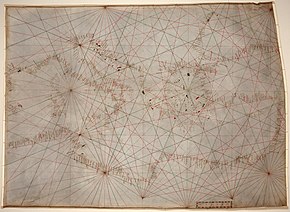
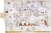
A broader definition of portolan chart accepts any sea chart or atlas that meets the following series of stylistic requirements: drawn by hand, with a network of rhumb lines that emanate from the center of hidden circles, focused on the coasts and islands, with place names written perpendicular to the coastline on the land side and with sparse information about the interior of landmasses.
[8][9] This broader definition encompasses charts of potentially any sea and even maps of the entire world, which are sometimes called nautical planispheres, provided they meet the aforesaid criteria.
[13] The portolan chart combined the exact notations of the text of the periplus or pilot book with the decorative illustrations of a medieval T and O map.
Portolans failed to take into account the curvature of the Earth; as a result, they were not helpful as navigational tools for crossing the open ocean, and were replaced by later Mercator projection charts.
The copious number of Italian portolan charts begins in the mid 13th century, with the oldest called Carta Pisana, which is kept in the National Library in Paris.
To the next century belong the Carignano Chart, disappeared from the National Archive of Florence where it had been conserved for a long time; cartographic works of the Genoese Pietro Vesconte, the illustrator of the work of Marino Sanudo; the chart of Francisco Pizigano (1373), with stylistic influence from Mallorca; and those of Beccario, Canepa and the brothers Benincasa, natives of Ancona.
The masterpiece of the Majorcan portolan charts is the Catalan Atlas made by Abraham Cresques in 1375, and kept in the Bibliothèque Nationale de France in Paris.
The newest of the Cresques World Map is the representation of Asia, from the Caspian sea to Cathay (China), which takes into account information from Marco Polo, and Jordanus .
To the 15th century corresponds the famous portolan chart by Gabriel Vallseca, (1439), kept in the Maritime Museum of Barcelona, notable for its delicacy of execution and lively picturesque details, masked by a spot of ink left by Frédéric Chopin and George Sand.
[25][26] It has been proposed that portolan charts evolved from the mental maps that Mediterranean pilots had used since ancient times, which had been transmitted orally over generations.
Charts also started to be drawn by Portuguese and Spanish mapmakers for the newly explored seas in Africa, America, South Asia and the Pacific.