Proportional symbol map
That said, there are gray areas between these three types of proportional map: a Dorling cartogram essentially replaces the polygons of area features with a proportional point symbol (usually a circle), while a linear cartogram is a kind of flow map that distorts the length of linear features proportional to a variable (often travel time).
Arthur H. Robinson credited Henry Drury Harness with the first map to clearly attempt to portray point sizes proportionally, on an 1838 map of cargo traffic in Ireland (with proportional widths) that showed city population.
The official report of the 1851 Census of Great Britain included several maps drawn by a W. Bone, showing significant towns sized proportionally to population (apparently range-graded), including one of the first useful legends.
[4] Charles Joseph Minard produced several proportional symbol maps, including the innovations of using them to represent regions rather than points, and incorporating color and statistical charts in the point symbols.
[6] Several cartography professors began to experiment with new mapping techniques, notably the use of spheres with a proportional volume rather than area by Sten de Geer (1922) and Guy-Harold Smith (1928),[7][8] and the use of transparency to resolve overlapping circles by Smith (1928) and Floyd Stilgenbauer (1932), the latter of which included a unique legend.
One of the earliest and most well-known of these studies was the PhD dissertation of James J. Flannery, who studied the ability of people to judge the relative areas of proportional circles, finding that Stevens's power law applied such that map readers underestimated circle area by a fairly predictable amount, leading to the Flannery Scaling Adjustment still in use today.
[11] Starting in the early 1990s, almost all proportional symbol maps have been created using geographic information system (GIS) and graphics software, with increasing capability for professional design.
In Semiology of Graphics, Jacques Bertin argued that of all of his visual variables, size was most intimately tied to a single interpretation.
[15] That is, a larger symbol looks like more of something and thus more important, and it is very difficult to interpret it any other way (e.g., as qualitatively different nominal categories).
Based on these principles, only ratio variables (per Stevens' levels of measurement) are appropriate to represent with size, specifically those in which negative values are not possible.
[1][16][17] Some ratio variables can be appropriate for both choropleth and proportional symbol maps, especially those that are spatially intensive (i.e., fields) but still represent an amount or count in some way.
[14]: 303 Ordinal qualitative variables can also be appropriate, if the goal is a simple representation of "small," "medium," and "large."
If there is a low degree of variation (i.e., a ratio of less than 10), most of the symbols will look nearly the same size and the map will be relatively uninformative.
[14]: 303 The primary goal in selecting a point symbol to use in a proportional symbol map is that users should be able to accurately judge sizes, both in comparison to the legend to estimate data values, and in comparison to each other to judge relative patterns.
[1][18]: 136 Secondary goals include aesthetic appeal and an intuitive shape that is easy to interpret.
Pictorial or pictographic symbols, which use an iconic shape (usually a silhouette) that evokes the represented phenomenon (e.g., a shaft of wheat to represent wheat production) can give the map an intuitive look, but their complexity can increase the overall feel of clutter, and it can be more difficult to judge their size than simple geometric shapes like circles or squares, especially if they are in a congested area where individual symbols overlap.
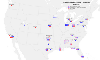
Among geometric symbols, circles have been the predominant shape since this type of thematic map was invented.
They can add an aesthetic appeal, but they were originally designed for their function, to allow large symbols to be smaller because the value would be proportional to volume rather than area.
[22] Eduard Imhof argued against this technique (which he called count frame diagrams) for point locations, on the grounds that it tends to be much larger and more complex than a simple point symbol, covering more of the underlying geography; however, he found them effective on region locations, especially if the count consists of different types of individuals.
However, making this work in practice can lead to some challenges, so several methods of scaling have been developed.
In his 1956 PhD Dissertation, James Flannery conducted psychophysical experiments into how well map readers judged the relative size of proportional circles.
He and Arthur H. Robinson immediately began encouraging cartographers to compensate for this effect by increasing the difference between circle sizes accordingly, using a technique called apparent magnitude scaling.
[24] According to Flannery's results, this can be accomplished by increasing the exponent of the scaling factor slightly, replacing the above formula with the following:[1]: 139
Various studies have resulted in different magnitudes of the effect, and some have argued that the effect is not large enough to require the effort of compensation, that map readers can make adequate judgments with absolute scaling, as long as a clear legend is provided to help.
Some software, such as Esri ArcGIS Pro, allow for the option to control the size of both ends of the value range.
Instead, the range of possible values is classified as it would be in a choropleth map, and a single size of symbol is assigned to each class.
However, it has inherent issues, in that it makes similar values appear identical, and that apparent size differences cannot be interpreted as a ratio; that is, a value of one feature being twice that of another feature is not necessarily represented as a symbol of twice the size.
[23]: 190 That said, there is general consensus that some overlap is acceptable, because eliminating all overlap would often require reducing symbol size so much that it would be difficult to judge size, or reducing the number of features to the degree that the map would be uninformative.