Timeline of the 2017 Atlantic hurricane season

These dates, adopted by convention, historically describe the period in each year when most tropical systems form.

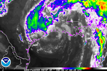
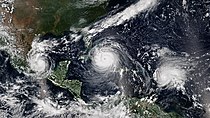
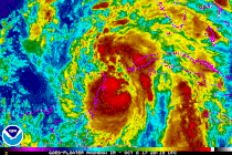
[5] This timeline documents tropical cyclone formations, strengthening, weakening, landfalls, extratropical transitions, and dissipations during the season.

The time zones utilized (east to west) prior to 2020 were: Atlantic, Eastern, and Central.

[7] In this timeline, all information is listed by UTC first with the respective regional time included in parentheses.

Additionally, figures for maximum sustained winds and position estimates are rounded to the nearest 5 units (knots, miles, or kilometers), following the convention used in the National Hurricane Center's products.

A satellite image of Tropical Storm Arlene located to the west of the Azores on April 20, 2017.
Tropical Storm Arlene west of the Azores on April 20
An infrared satellite loop image showing Tropical Storm Cindy making landfall in Louisiana on June 22, 2017.
Infrared satellite loop of Tropical Storm Cindy making landfall in Louisiana on June 22
Tropical Storm Emily shortly after landfall in Florida on July 31, 2017.
Tropical Storm Emily shortly after Florida landfall on July 31
Hurricane Franklin near peak intensity as a Category 1 hurricane on August 9, 2017.
Hurricane Franklin near peak intensity on August 9
2017 Atlantic Hurricane storm tracks with IMERG precipitation and GOES clouds (from August 10 to September 23)
A satellite image of the three hurricanes that were active in the Atlantic Ocean on September 8, 2017.
Three simultaneous hurricanes active in the Atlantic on September 8: Katia (left), Irma (center), and Jose (right)
A map plotting the track and intensity of Hurricane Lee at 6-hour intervals during its September 14–30, 2017, lifetime.
Map plotting the track and the intensity of Lee (starting at lower right corner)
A satellite picture of Hurricane Maria as a Category 5 hurricane on September 19, 2017.
Hurricane Maria near peak intensity, moving towards Puerto Rico , on September 19
Infrared satellite loop of Hurricane Nate as it enters the Gulf of Mexico on October 7, 2017.
Rainbow infrared satellite loop of Hurricane Nate entering the Gulf of Mexico on October 7
A map plotting the track and intensity of Hurricane Ophelia at 6-hour intervals during its October 9–15, 2017, lifetime.
Map plotting the track and the intensity of Ophelia (starting at lower left corner)
A satellite image of Tropical Storm moving across the northern Atlantic Ocean on November 8, 2017.
Tropical Storm Rina moving across the northern Atlantic Ocean on November 8