Tropical Storm Linfa (2015)
It turned northward and strengthened to near typhoon intensity, or winds of 120 km/h (75 mph), but weakened as it curved to the northwest toward southern China.
Interacting with the monsoon, Linfa brought heavy rainfall across much of the Philippines for several days, causing flooding and landslides that resulted in traffic accidents and power outages.
Toward the end of June, a westerly wind burst moved across the western Pacific Ocean, spawning Typhoon Chan-hom as well as the storm that would become Linfa.
[1] On July 1, a large area of convection persisted east of the Philippines, with an associated circulation exposed due to moderate wind shear.
At 06:00 UTC that day, the Joint Typhoon Warning Center (JTWC) assessed a low probability of tropical cyclogenesis over the subsequent 24 hours.
[2] However, the system quickly organized, prompting the JTWC to issue a tropical cyclone formation alert later that day, indicating that a storm would likely form imminently.
[3] At 18:00 UTC on July 1, the Japan Meteorological Agency (JMA) estimated that a tropical depression developed about 500 km (310 mi) east-northeast of the Philippine island of Samar.
[5] Despite persistent shear dislocating the convection,[7] the JMA upgraded the system to a tropical storm at 12:00 UTC on July 2, naming it Linfa.
[8] On July 3, Linfa's track briefly shifted to the southwest, by which time the convective structure had evolved into a central dense overcast.
This was due to potential interaction with Typhoon Chan-hom to the northeast, and differences in storm models whether an approaching trough would turn Linfa to the east or the west.
[4] As Linfa neared the northern Philippines, the bulk of the convection was shifted to the southern periphery, due to the continued wind shear.
[4] The JTWC assessed further strengthening, upgrading Linfa to typhoon status at 18:00 UTC that day based on a developing well-defined eye.
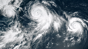
[22] As the storm approached the southern China coast, the eye expanded to a diameter of 37 km (23 mi), while the thunderstorms on the northern periphery diminished.
[23] Around 03:00 UTC on July 9, Linfa made landfall east of Hong Kong near Lufeng, Guangdong, and it quickly weakened once over land.
[26] At 18:00 UTC on July 9, the JTWC issued their final advisory for Linfa,[27] and shortly after the JMA downgraded the storm to a tropical depression.
[28] Due to the enhancement of the southwest monsoon by the storm, all ships in the Port of Manila were ordered to remain in harbor,[29] and 20 flights were cancelled in northern Luzon.
[1] The outskirts of the storm increased winds across eastern Malaysia, which knocked down trees and destroyed the roofs of eight school and several houses.
[28] In the Ilocos region, a Chinese fishing vessel docked at Currimao port ran aground after being battered by huge waves.
[42] Three days of high waves washed 30 tons of mussels ashore Valladolid, Negros Occidental, prompting officials to use trucks to bury the rotting shells to prevent the spread of disease.

Tropical storm (39–73 mph, 63–118 km/h)
Category 1 (74–95 mph, 119–153 km/h)
Category 2 (96–110 mph, 154–177 km/h)
Category 3 (111–129 mph, 178–208 km/h)
Category 4 (130–156 mph, 209–251 km/h)
Category 5 (≥157 mph, ≥252 km/h)
Unknown