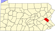
Whitehall Township, Pennsylvania
[5] The Province of Pennsylvania was created in 1681 when King Charles II granted a tract of land in America to William Penn.
When the first European settlers came to the Whitehall area, the Lenape people were living on the banks of Hokendauqua Creek.
But the tribe suffered injustices at the hands of the settlers and lashed back during a 1763 uprising in Lehigh County.
Fort Deshler, which stood near Route 145 at Chestnut Street, played a key role in the defense of settler-held lands during this battle, in which 23 settlers were killed.
Whitehall Township's villages include Cementon, Egypt, Fullerton, Hokendauqua, Mickleys, Stiles, and West Catasauqua.
There were six grist mills in Whitehall, built to process grains for the farmers into flour and animal feed.
This was immediately followed by the establishment of a railroad system to transport raw materials to the furnaces and to ship the final product.
While the railroads were being constructed, cuts in the bedrock led to the discovery of Whitehall's deposits of Jacksonburg limestone.
This gave the township specified municipal rights for supplying electric lights, highways, and sewers at public expense.
The individual villages united into a single entity known as Whitehall in 1968, when the U.S. Post Office combined its separate town branches.
In 1974, voters approved the adoption of a Home Rule Charter form of government, creating a seven-member legislative body and an elected mayor.
Today, with an annual budget in excess of $21 million, Whitehall provides a full range of municipal services to its residents.
The name "Whitehall" refers to a white hall that was built along Jordan Creek in the early 1700s as a hunting lodge.
The new Whitehall Township is generally rectangular in shape, running from north-northwest to south-southeast, and is situated along the western bank of the Lehigh River.
The township's villages include Cementon, Eagle Point, Egypt, Fullerton, Hokendauqua, Mickleys, North Coplay, Scherersville (also in South Whitehall), Stiles, and West Catasauqua.
On November 5, 1974, the township adopted a Home Rule Charter (here) form of government that became effective January 5, 1976.
US 22 passes east–west through the southern portion of Whitehall Township on a freeway called the Lehigh Valley Thruway, with interchanges at PA 145 and Fullerton Avenue.
US 22 leads west to connections with PA 309, I-476 (Pennsylvania Turnpike Northeast Extension), and I-78 and east to Bethlehem and Easton.
PA 329 passes east–west through the northern portion of Whitehall Township on Main Street, leading west to Schnecksville and east to Northampton and Bath.
[18] LANta provides bus service in Whitehall Township with several routes serving the MacArthur Road retail corridor and a transfer center located at the Lehigh Valley Mall.


