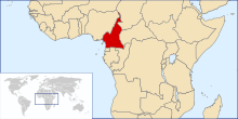
Geography of Cameroon
The country is located in Central and West Africa, bordering the Bight of Biafra, between Equatorial Guinea and Nigeria.
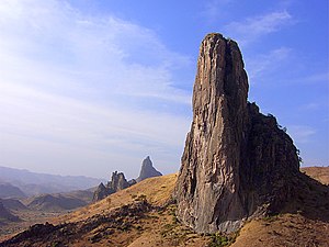
Cameroon is sometimes described as "Africa in miniature" because it exhibits all the major climates and vegetation of the continent: mountains, desert, rain forest, savanna grassland, and ocean coastland.
[3][4] Cameroon's coastal plain extends 20 to 80 kilometres (10 to 50 mi) inland from the Gulf of Guinea (part of the Atlantic Ocean) to the edge of a plateau.
The plain is densely forested including areas of Central African mangroves especially around Douala and in the estuary of the Cross River on the border with Nigeria.
[5] The low South Cameroon Plateau, rising from the coastal plain and dominated by tropical rain forest, has an average elevation of 500 to 600 metres (1,500 to 2,000 ft).
From the forested southern plateau the land rises northward to the grassy, rugged Adamaoua (Adamawa) highlands.
This is region of sparse rainfall and high median temperatures has been included as part of the East Sudanian savanna ecoregion.
[6] The wide diversity of climates and natural regions of Cameroon, as coastline, mountains, savanna, deserts, and tropical forests, allows that the country counts with rich biodiversity.
In the south, the principal rivers flow southwestward or westward directly to the Gulf of Guinea – the Wouri, and lesser Dibamba, Bimbia and Mungo to the Cameroon estuary near Douala; Sanaga, Nyong, and Ntem further south along the coast; Akwayafe and Manyu (which joins Nigerian Cross), and the lesser Ndian and Meme north of the coast.
Cameroon) 4,095 m Natural resources: petroleum, bauxite, iron ore, timber, hydropower Land use: arable land: 13.12% permanent crops: 3.28% other: 83.61% (2012) Irrigated land: 256.5 km2 (2003) Total renewable water resources: 285.5 km3 (2011) Freshwater withdrawal (domestic/industrial/agricultural): total: 0.97 km3/yr (23%/10%/68%) per capita: 58.9 m3/yr (2005) Natural hazards: Recent limnic eruptions with release of carbon dioxide: Environment – current issues: water-borne diseases are prevalent; deforestation; overgrazing; desertification; poaching; overfishing Environment – international agreements: party to: Biodiversity, Climate Change, Desertification, Endangered Species, Hazardous Wastes, Law of the Sea, Ozone Layer Protection, Tropical Timber 83, Tropical Timber 94, Wetlands, Whaling signed, but not ratified: Nuclear Test Ban Geography – note: sometimes referred to as 'the hinge of Africa;' throughout the country there are areas of thermal springs and indications of current or prior volcanic activity; Mount Cameroon, the highest mountain in Sub-Saharan west Africa, is an active volcano This is a list of the extreme points of Cameroon, the points that are farther north, south, east or west than any other location.