Hurricane Walaka
Hurricane Walaka was a strong tropical cyclone that brought high surf and a powerful storm surge to the Northwestern Hawaiian Islands.
[2] The tropical cyclone originated from an area of low pressure that formed around 1,600 mi (2,600 km) south-southeast of Hawaii on September 24.
Walaka peaked as a Category 5 hurricane, with winds of 160 mph (260 km/h) and a pressure of 921 mbar (27.20 inHg), early on October 2.
Afterward, less favorable conditions caused a steady weakening of the hurricane, and Walaka became extratropical on October 6, well to the north of the Hawaiian Islands.
Several dozen people had to be rescued off the southern shore of Oahu as the storm brought high surf to the main Hawaiian Islands.
[3] Two days later, a trough – an elongated region of low atmospheric pressure – formed around 1,600 mi (2,600 km) south-southeast of Hilo, Hawaii.
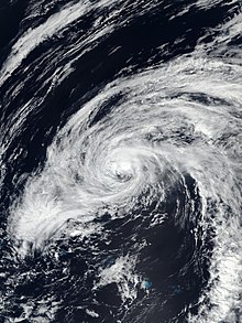
Six hours later, the system strengthened into a tropical storm, receiving the name Walaka from the Central Pacific Hurricane Center (CPHC).
[1][5] The nascent tropical storm was located in an environment of warm 84–86 °F (29–30 °C) sea surface temperatures, low vertical wind shear, and humid air.
[10] Walaka peaked as a Category 5 hurricane, with maximum sustained winds of 160 mph (260 km/h) and a minimum central pressure of 921 mbar (27.20 inHg), at 00:00 UTC on October 2.
[16] After completing the eyewall cycle, Walaka reintensified slightly, reaching a secondary peak of 145 mph (233 km/h) around 12:00 UTC on October 3.
[19] Walaka moved across the Papahanaumokuakea Marine National Monument near Brooks Banks, a submerged volcanic cone, around 06:20 UTC on October 4.
[1] Environmental conditions deteriorated even further on October 4 as sea surface temperatures fell below 81 °F (27 °C) and ocean heat content decreased.
[21] The wind shear abated later on October 5, although sea surface temperatures along the remainder of the tropical storm's track were cooler than 77 °F (25 °C).
As a result of the decreased shear, Walaka's low-level center was temporarily recovered by convection and the weakening trend slowed as the storm continued north-northwest.
[26][27] Seven researchers studying Hawaiian monk seals and green sea turtles on French Frigate Shoals were evacuated to Honolulu on October 2.
The small, low-lying East Island suffered a direct hit and was completely destroyed, sediment being scattered across coral reefs to the north.
[31] Coral reefs near the French Frigate Shoals, Lisianski Island, and the Pearl and Hermes Atoll were substantially damaged, displacing the native fish population.

Tropical storm (39–73 mph, 63–118 km/h)
Category 1 (74–95 mph, 119–153 km/h)
Category 2 (96–110 mph, 154–177 km/h)
Category 3 (111–129 mph, 178–208 km/h)
Category 4 (130–156 mph, 209–251 km/h)
Category 5 (≥157 mph, ≥252 km/h)
Unknown