Timeline of the American Old West
The term "American Old West" refers to a vast geographical area and lengthy time period of imprecise boundaries, and historians' definitions vary.
The events in this timeline occurred primarily in the portion of the modern continental United States west of the Mississippi River, and mostly in the period between the Louisiana Purchase in 1803 and the admission of the last western territories as states in 1912 where most of the frontier was already settled and became urbanized; a few typical frontier episodes happened after that, such as the admission of Alaska into the Union in 1959.
Western North America was inhabited for millennia by various groups of Native Americans and later served as a frontier to the Spanish Empire, which began colonizing the region starting in the 16th century.
"[2] For almost three centuries after Columbus' voyages to the New World, much of western North America remained unsettled by white colonists, despite various territorial claims made by European colonial powers.
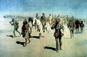
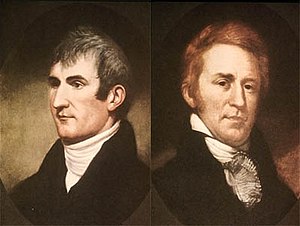
[3]: 150 The early years were also a period of scientific exploration and survey, such that by 1830 the rough outline of the western half of the continent had been mapped to the Pacific Ocean.