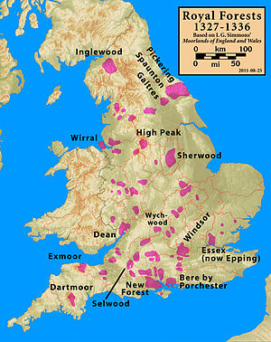
Exmoor
The moor has given its name to a National Park, which includes the Brendon Hills, the East Lyn Valley, the Vale of Porlock and 55 km (34 mi) of the Bristol Channel coast.
The terrain supports lowland heath communities, ancient woodland and blanket mire which provide habitats for scarce flora and fauna.
In the Middle Ages sheep farming was common with a system of agistment licensing the grazing of livestock as the Inclosure Acts divided up the land.
Neighbouring natural regions include The Culm to the southwest, the Devon Redlands to the south and the Vale of Taunton and Quantock Fringes to the east.
[2] The Exmoor National Park is primarily an upland area with a dispersed population living mainly in small villages and hamlets.
[20] The Exmoor Coastal Heaths have been recognised as a Site of Special Scientific Interest due to the diversity of plant species present.
The mean annual temperature at Simonsbath is 8.3 °C (46.9 °F) with a seasonal and diurnal variation, but due to the modifying effect of the sea the range is less than in most other parts of the UK.
The south-west of England has a favoured location with regard to the Azores high pressure when it extends its influence north-eastwards towards the UK, particularly in summer.
In summer, convection, caused by the sun heating the land surface more than the sea, sometimes forms rain clouds and at that time of year a large proportion of the rainfall comes from showers and thunderstorms.
This rainfall, which followed an exceptionally wet summer, led to disastrous flooding in Lynmouth with 34 dead and extensive damage to the small town.
[41] In the Neolithic period, people started to manage animals and grow crops on farms cleared from the woodland, rather than act purely as hunters and as gatherers.
[42] It is also likely that extraction and smelting of mineral ores to make metal tools, weapons, containers and ornaments started in the late Neolithic, and continued into the Bronze and Iron Ages.
[43] An earthen ring at Parracombe is believed to be a Neolithic henge dating from 5000–4000 BC, and Cow Castle, which is where White Water meets the River Barle, is an Iron Age fort at the top of a conical hill.
The stone slabs weigh up to 5 tonnes apiece, and the bridge has been designated by English Heritage as a grade I listed building,[45] to recognise its special architectural, historical or cultural significance.
[59] According to the late 13th-century Hundred Rolls, King Henry II of England (d. 1189) gave William of Wrotham the office of steward of Exmoor.
[63] The Botreaux family had long held the manor of Molland at the southern edge of Exmoor, but were probably resident mainly at North Cadbury in Somerset.
[64] Sir John Poyntz of Iron Acton, Gloucestershire, was warden or chief forester of Exmoor in 1568 when he brought an action in the Court of Exchequer against Henry Rolle (of Heanton Satchville, Petrockstowe), the powerful lord of the manors of Exton, Hawkridge and Withypool.
The wool was spun into thread on isolated farms and collected by merchants to be woven, fulled, dyed and finished in thriving towns such as Dunster.
The land started to be enclosed and from the 17th century onwards larger estates developed, leading to establishment of areas of large regular shaped fields.
[75] The site is also of importance for its breeding bird communities, its large population of the nationally rare heath fritillary (Mellicta athalia),[18] an exceptional woodland lichen flora and its palynological interest of deep peat on the Chains.
[75] The South Exmoor SSSI is smaller, covering 3,132.7 hectares (7,741 acres)[9] and including the River Barle and its tributaries with submerged plants such as alternate water-milfoil (Myriophyllum alterniflorum).
The most abundant tree species is sessile oak (Quercus petraea), the shrub layer is very sparse and the ground flora includes bracken, bilberry and a variety of mosses.
There are also 3,000 hectares (7,400 acres) of Forestry Commission woodland,[77] comprising a mixture of broad-leaved (oak, ash and hazel) and conifer trees.
The Emperor of Exmoor, a red stag (Cervus elaphus), was Britain's largest known wild land animal, until it was killed in October 2010.
Birds seen on the moor include merlin, peregrine falcon, Eurasian curlew, European stonechat, dipper, Dartford warbler and ring ouzel.
[90] Sightings were first reported in the 1970s although it became notorious in 1983, when a South Molton farmer claimed to have lost over 100 sheep in the space of three months, all of them apparently killed by violent throat injuries.
In response to these reports Royal Marine Commandos were deployed from bases in the West Country to watch for the mythical beast from covert observation points.
[98] The National Park Authority operates CareMoor for Exmoor as an opportunity for those that appreciate the area to give back, with donations supporting conservation and access projects.
Sightseeing, walking, cycling and mountain biking taking in Exmoor's dramatic heritage coastline and moorland countryside scenery are the main attractions.
[102] The attractions of Exmoor include 208 Scheduled monuments, 16 conservation areas, and other open access land as designated by the Countryside and Rights of Way Act 2000.