Geography of Minnesota
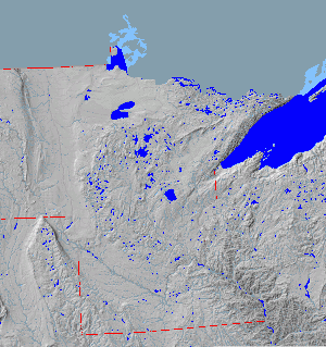
[3][4] About 2.7 billion years ago, basaltic lava poured out of cracks in the floor of the primordial ocean; this volcanic activity created the Canadian Shield in northeast Minnesota.
[3] In more recent times, massive ice sheets at least one kilometer thick ravaged the landscape of the state and sculpted its current terrain.
[11] The Mississippi River begins its journey from its headwaters at Lake Itasca and crosses the Iowa border 680 miles (1,094 km) downstream.
The Red River, in the bed of glacial Lake Agassiz, drains the northwest part of the state northward toward Canada's Hudson Bay.
[13] The northern coniferous forests are a vast wilderness of pine and spruce trees mixed with patchy stands of birch and poplar.
[15] While loss of habitat has affected native animals such as the pine marten, elk, and bison,[16] whitetail deer and bobcat thrive.
Located on the Mississippi Flyway, Minnesota hosts migratory waterfowl such as geese and ducks, and game birds such as grouse, pheasants, and turkeys.
The lakes teem with sport fish such as walleye, bass, muskellunge, and northern pike, and streams in the southeast are populated by brook, brown, and rainbow trout.
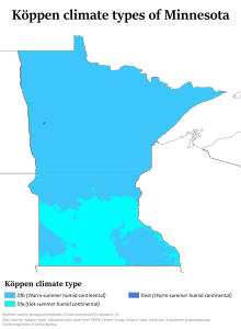
Minnesota endures temperature extremes characteristic of its continental climate; with cold winters and hot summers, the record high and low span 174 degrees Fahrenheit (79 °C).
[18] Meteorological events include rain, snow, hail, blizzards, polar fronts, tornadoes, thunderstorms, and high-velocity derechos and downbursts.
The Superior National Forest in the northeast contains the Boundary Waters Canoe Area Wilderness, which encompasses over a million acres (4,000 km2) and a thousand lakes.
It is also geographically more diverse, with farmlands to the south and west, lake country in central Minnesota, and forests in the northern part of the state.