Hurricane Omar
Hurricane Omar was a powerful tropical cyclone that took an unusual southwest to northeast track through the eastern Caribbean Sea during mid-October 2008.
Forming out of a tropical disturbance on October 13, Omar initially moved slowly in the eastern Caribbean Sea.
Early on October 16, Omar reached its peak intensity with maximum winds of 130 mph (210 km/h) and a barometric pressure of 958 mbar (958 hPa; 28.3 inHg).
After slightly re-strengthening the next day, Omar weakened to a tropical storm before degenerating into a non-convective low pressure area.
On September 30, a well-developed tropical wave moved off the eastern coast of Africa and entered the Atlantic Ocean.
Continued development followed and the low was designated as Tropical Depression Fifteen at 0600 UTC on October 13 while located about 190 miles (310 kilometres) south of the southeastern tip of the Dominican Republic.
[1] Located to the southeast of a broad and deep tropospheric trough and to the west of a low to mid-level ridge, Omar took a counter-clockwise turn on October 14.
Upon becoming a tropical storm, Omar began to undergo an extended period of rapid intensification as very deep convection developed around the center of circulation.
[3] Later that day, an 11.5 to 17.2 mi (18.5 to 27.7 km) wide eye formed[4] as the storm began to turn towards the northeast due to the trough.
[1] With the formation of an eye, the Dvorak technique rendered an intensity of 75 mph (121 km/h), signifying that Omar had intensified into a hurricane.
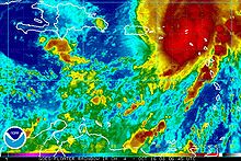
Visible satellite images depicted an exposed low-level circulation with convection displaced to the east due to a combination of very high wind shear and dry air.
Later that day, the trough that caused the rapid northeastern motion bypassed Omar, leading to decreasing movement.
[1] A weakening storm, Omar continued towards the northeast due to a mid to upper-level ridge located south of the system and the mid-latitude westerlies to the north.
Twelve hours later, while still producing tropical storm-force winds, the storm degenerated into a remnant low-pressure area.
That same day, a Hurricane Warning and flash flood watch were put in place in anticipation of hurricane-force winds and torrential rains from Omar.
[10] Also, on Anguilla, residents in the Sandy Ground, Valley Bottom, Welches and Mount Fortune areas were placed under evacuation orders.
[12] Omar produced moderate damage throughout numerous islands, amounting to at least $80 million (2008 USD) and one death was related to the storm.
While it was moving little over the south-central Caribbean, Omar brought prolonged tropical storm conditions to the ABC Islands.
Sustained winds to near gale force battered the islands, although peak gusts to 58 mph (93 km/h) were confined to Bonaire.
[13] In the SSS Islands (Saba, St. Eustatius, and Sint Maarten) strong winds from Omar, gusting up to 76 mph (122 km/h), and high waves caused significant damage and coastal flooding.
[23] As a tropical wave, the precedent to Omar produced heavy rains over the island, causing minor flooding.
[24] After passing by Puerto Rico a second time, Omar produced locally heavy rains, which caused minor street flooding.
[25] On St. Croix, waves up to 15 ft (4.6 m) from Omar sank about 47 boats,[26] leading to a large oil spill around the islands.
The storm surge also flooded parts of the Anse la Raye Quarter, leading to officials declaring a mandatory evacuation of the area.
Several non-profit organizations also received support from FEMA, while those that did not meet the criteria were referred to the Small Business Administration's low-interest loan program.
[33] On Dominica, Omar's close pass to the island left 30 families homeless and severely hampered the fishing community.
On December 15, the Board of Directors of the Caribbean Development Bank approved $9.16 million for assistance to those affected by Omar on the island and to restore the infrastructure damaged by the hurricane.

Tropical storm (39–73 mph, 63–118 km/h)
Category 1 (74–95 mph, 119–153 km/h)
Category 2 (96–110 mph, 154–177 km/h)
Category 3 (111–129 mph, 178–208 km/h)
Category 4 (130–156 mph, 209–251 km/h)
Category 5 (≥157 mph, ≥252 km/h)
Unknown