Principal Triangulation of Great Britain
In addition there was a purely scientific aim in providing precise data for geodetic calculations such as the determination of the length of meridian arcs and the figure of the Earth.
In the aftermath of the Jacobite rising of 1745 it was recognised that there was a need for an accurate map of the Scottish Highlands and the necessary survey was initiated in 1747 by Lieutenant-Colonel David Watson, a Deputy Quartermaster-General of the Board of Ordnance.
Subsequently, Roy, having enlisted in the army and having become a very competent surveyor, proposed (1763) a national survey which would be a plan for defence at a time when French invasions were threatened.
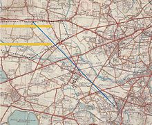
Roy's first task (1784) was to measure a baseline between Hampton Poor House (51°25′35″N 0°21′57″W / 51.4265°N 0.3657°W / 51.4265; -0.3657) and King's Arbour (51°28′47″N 0°27′01″W / 51.4798°N 0.4503°W / 51.4798; -0.4503) on Hounslow Heath, a distance of just over 5 miles (8 km).
[5][6] The theodolite was the largest ever constructed but, despite its massive size, it was carried from London to the Channel coast and employed on hills, steeples and a moveable tower.
As Master of the Board of Ordnance (from 1782), Charles Lennox, 3rd Duke of Richmond, viewed Roy's work with great interest, At the same time he was acutely aware that Britain, lacking a national survey, was falling behind the standards of many other European countries.
For the 1784 measurement of the original baseline across Hounslow Heath, Roy had ordered three deal rods cut from a new mast in the Admiralty dock yards.
As the survey proceeded westwards, Mudge decided to check its accuracy by measuring a new baseline between two points established by the triangulation.
[16] During subsequent triangulation, errors due to atmospheric refraction, deflection of plumb-bobs, temperature, and the spherical nature of the earth (meaning there were more than 180 degrees in a triangle) were all allowed for.