Hurricane Bob
After peaking in intensity with maximum sustained winds of 115 mph (185 km/h), Bob weakened slightly as it approached the coast of New England.
The remnants traveled a long distance across the northern Atlantic Ocean, and finally dissipated west of Portugal on August 29.
By August 15th, satellite analysis of the system found a weak low-pressure area a couple hundred miles east of the Bahamas.
[8] Operationally, the system was not declared a tropical depression until 0600 UTC on August 16 after a reconnaissance mission into the storm found a closed circulation and flight level winds of 37 mph (60 km/h).
Roughly 18 hours after being declared a depression, the National Hurricane Center (NHC) upgraded it to a tropical storm, giving it the name Bob.
[8] Shortly after, the hurricane began to turn towards the north-northeast in response to a subtropical ridge over the Atlantic and the trough over the southeastern United States.
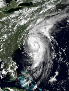
Early the next day, the eye became increasingly defined as the center of Bob passed roughly 35 mi (56 km) from the North Carolina coastline.
After attaining this intensity, the hurricane tracked quickly northeast at 25 mph (40 km/h), steered by the trough over the southeastern United States, an upper-level cutoff low over the Great Lakes Region and the subtropical ridge over the Atlantic.
Around 1800 UTC, the center of Bob made landfall near Newport, Rhode Island, with winds of 100 mph (160 km/h), making it a Category 2 hurricane.
A new hurricane watch was issued late on August 17, encompassing areas between Virginia Beach northward to Cape Henlopen, Delaware.
[14] A new, extensive hurricane warning was issued late on August 18 when forecasts showed Bob moving directly over southern New England.
[15] Following the issuance of a hurricane warning in North Carolina on August 17,[14] mandatory evacuation orders were declared for the outermost islands in the state.
Several bridges in the area were shut down prior to Bob's arrival as hurricane-force winds were likely to create life-threatening conditions on them.
Roughly 400 people evacuated from coastal areas in Maryland, and stores in Ocean City reported a substantial increase in sales related to storm preparation.
[19] Prior to Bob's arrival in New England, officials in Connecticut and Rhode Island declared a state of emergency in anticipation of significant damage.
The Connecticut Legislature canceled a session on the state's budget and Governor Lowell P. Weicker Jr. activated the emergency operations center.
President George H. W. Bush, staying at his home in Kennebunkport, Maine, evacuated to Pease Air Force Base in New Hampshire.
During this time, portions of Interstate 95 were closed to allow him direct access to the Air Force base; however, this created many miles of backup as thousands of residents moved inland.
[28] That made it, at the time, one of the costliest United States hurricanes, although the total was due to the storm passing through a densely populated region.
[32] The center of Hurricane Bob passed several hundred miles east of South Carolina with only slight effects on the state.
[33] On August 18, 1991, Hurricane Bob brushed the Outer Banks of North Carolina, bringing strong winds and heavy rains.
[16] Six brief tornadoes, ranging between F0 and F1 on the Fujita scale, struck the state within squall lines in the outer rainbands of Hurricane Bob.
[19] The high waves destroyed fish nets offshore [43] and caused beach erosion and the widespread destruction of boats along the coast.
[42] Although it remained offshore of the state, Bob produced strong winds in New Hampshire, with gusts reaching 60 mph (97 km/h) at Pease Air National Guard Base.
[46] Although moving across Maine as a tropical storm, Bob still maintained strong winds, producing gusts to 70 mph (110 km/h) in Portland.
[58] At the time, its 24‑hour rainfall total of 7.83 in (199 mm) was the highest on record, although it was surpassed in October 1996 by an extratropical system fueled by Hurricane Lili.
[68] To facilitate the federal government's response effort, President George H. W. Bush declared the following states as disaster (in order): Rhode Island, Massachusetts, Maine, Connecticut, New Hampshire, and New York.
[60] Instead, the declaration allocated federal funding to reimburse cities for debris removal, repairing damaged public buildings, and other municipal expenses for each of the states.
This was partially due to President Bush considering the storm a "disaster but not an emergency", which therefore required cuts from other budgets to offset the relief aid.
[70] Due to the hurricane's effects in the United States, the name Bob was subsequently retired by the World Meteorological Organization in the spring of 1992, and will never be used again for an Atlantic tropical system.

Tropical storm (39–73 mph, 63–118 km/h)
Category 1 (74–95 mph, 119–153 km/h)
Category 2 (96–110 mph, 154–177 km/h)
Category 3 (111–129 mph, 178–208 km/h)
Category 4 (130–156 mph, 209–251 km/h)
Category 5 (≥157 mph, ≥252 km/h)
Unknown