Hurricane Emily (1993)
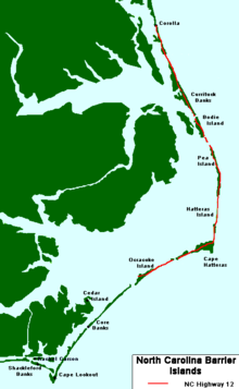
Although part of the eye passed over Hatteras Island in the Outer Banks, its absolute center remained 23 mi (37 km)/h) offshore.
A mandatory evacuation for Ocracoke and Hatteras islands displaced 160,000 people during the busy Labor Day weekend; the loss in tourism revenue amounted to $10 million (1993 USD).
While bypassing the Outer Banks, Emily produced strong winds that coincided with high tides during a full moon, causing severe flooding along the Pamlico Sound.
Moving northwestward,[1] the depression remained poorly organized for several days, with an ill-defined circulation center and sporadic thunderstorms, in part due to unfavorable wind shear from an upper-level low to its north.
[1] As the upper environment turned less hostile to development,[5] a reconnaissance aircraft found unusually high sustained winds—an indication that the cyclone had quickly strengthened into a strong tropical storm.
The NHC named the storm Emily and upgraded it to a hurricane the following day, based on reports of 75 mph (121 km/h) winds from a second reconnaissance mission.
Emily's winds vacillated between tropical storm and hurricane force over the course of the day, although the cyclone resumed its strengthening by August 28 upon developing favorable upper-level outflow.
[1][7] Traversing warm sea surface temperatures, the hurricane continued to improve in appearance on satellite images, and the barometric pressure within its eye steadily decreased.
[1][12] Early on August 31, a reconnaissance flight indicated that Emily had become a Category 2 hurricane on the Saffir–Simpson scale, and further intensification was expected because of warm waters.
Its eye measured 45 mi (72 km) in diameter, and a portion moved over Hatteras and the Pamlico Sound, constituting a direct hit but not a landfall.
[18] Emily turned to the southeast and diminished to a tropical storm on September 3, about 500 mi (800 km) northeast of Bermuda,[15] with a significant deterioration of the convection.
A hurricane warning was issued from Bogue Inlet to the border of North Carolina and Virginia on August 30, and was extended a day later to Cape Henlopen, Delaware.
[29] Because of the uncertainty in forecasting when and if Emily would make its northeast turn, Virginia Governor Douglas Wilder declared a state of emergency and put the National Guard on alert.
[32] To the north, officials in Ocean City, Maryland, declared a phase-one emergency ahead of the storm; beaches were closed, and tourists were recommended to leave.
[21] Across the Atlantic coast, 33 emergency shelters were opened in response to Emily,[36] though most evacuees instead relied on hotels or the homes of friends and relatives to ride out the storm.
[26][31] The North Carolina government announced ahead of the storm that it would not create a State Disaster Fund, instead relying on private relief organizations such as the American Red Cross and the Salvation Army.
[49] Coinciding with high tides during a full moon,[24] the hurricane's winds pushed water from the Pamlico Sound to the south, lowering levels along the mainland and inundating the barrier islands;[26] surge flooding was minor on the ocean side.
[50] At Frisco and Hatteras, water levels along the Pamlico Sound reached 8.5 ft (2.6 m) above normal—their highest in the 20th century, surpassing those in Hurricane Gloria eight years prior.
[42] The waters—1 to 2 ft (0.3 to 0.6 m) higher than the predicted 100-year flood—broke through windows and entered houses;[39] some residents who did not exit their homes had to ride out the storm in their attics to escape the flooding.
[24] The Cape Hatteras National Weather Service office was flooded for the first time since its inception in 1957,[50] and sustained damage to its rain chart and an antenna.
[52] Emily's winds destroyed several roofs and knocked down thousands of trees and power lines, with many signs and sheds damaged.
[54] The combination of strong winds and floods left 553 homes uninhabitable in the Outer Banks,[49] with 168 houses completely destroyed,[41] including three that were washed away.
[49] Rough surf killed two people in Nags Head,[21] despite the beach being closed to swimming,[56] and one person suffered injuries while escaping a flooded home.
[46] At Virginia Beach, the waves led to minor flooding along the Sandbridge section;[31] rough surf and a strong undertow drowned one swimmer there.
[49] As Emily's winds eased over land, various assessment teams left Fort Bragg, North Carolina, to determine the extent of damage.
[66] Shelters closed by September 1 and residents returned to their homes, although Hatteras Island remained off-limits to everyone but emergency workers for several days.
[54] Unemployment across Hatteras rose in the wake of the damage to local businesses,[41] and many restaurants lost product when their refrigerators failed during the power outages.

Tropical storm (39–73 mph, 63–118 km/h)
Category 1 (74–95 mph, 119–153 km/h)
Category 2 (96–110 mph, 154–177 km/h)
Category 3 (111–129 mph, 178–208 km/h)
Category 4 (130–156 mph, 209–251 km/h)
Category 5 (≥157 mph, ≥252 km/h)
Unknown