Commonwealth Avenue (Quezon City)
Commonwealth Avenue starts at Elliptical Road, which encircles the Quezon Memorial Circle.
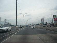
[3] A speed limit of 60 kilometers per hour (37 mph) is being enforced to reduce accidents on the avenue.
[4] Commonwealth Avenue follows a curving route from Elliptical Road to Quirino Highway.
It features partial access control with interchanges and U-turn slots replacing at-grade intersections and pedestrian crossings placed on overpasses (footbridges).
The avenue's origins can be traced back to a segment of a road that connected the proposed site of the National Capitol in what is now Elliptical Road to the University of the Philippines Diliman campus and comprises what is now University Avenue.
However, by 1949, the revised Frost Plan shifted focus to constructing a road directly connecting Quezon Memorial Circle, which replaced the original Capitol site that was scrapped after World War II, to the new National Government Center (location of the present-day Batasang Pambansa Complex) at Constitution Hill, which replaced the proposed PMA site.
During the late 1990s and early 2000s, the avenue was prone to heavy traffic and accidents due to increasing public utility vehicles plying the highway and sidewalk vendors crowding onto the road.
In the late 2000s, the Metropolitan Manila Development Authority (MMDA) cleared the sidewalk vendors, especially in the Tandang Sora area, which was prone to heavy rush hour traffic.
[19][20] Meanwhile, the Makabayan bloc wanted to rename the avenue after former Filipino senator Lorenzo Tañada.