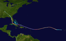
Tropical cyclone tracking chart
In paper form originally, computer programs were developed in the 1980s for personal home and use by professional weather forecasters.
Those used by weather forecasters saved preparation times, allowing tropical cyclone advisories to be sent an hour earlier.
Geographic information system (GIS) software allows end users to underlay other layered files onto forecast storm tracks to anticipate future impacts.
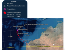
[11] The Vanuatu Meteorology and Geo-Hazards Department started preparing special tropical cyclone tracking charts for its archipelago in the 1980s.
At that time the United States Department of Defense was using paper maps, acetate, grease pencils, and disparate computer programs to forecast tropical cyclones.
[19] The Automated Tropical Cyclone Forecasting System (ATCF) software was developed by the Naval Research Laboratory for the Joint Typhoon Warning Center (JTWC) beginning in 1986,[20] and used since 1988.
[20][21] This provided the NHC with a multitasking software environment which allowed them to improve efficiency and cut the time required to make a forecast by 25% or 1 hour.
[20] Despite ATCF's introduction, into the late 1990s, a National Hurricane Center forecaster stated that the most important tools available were "a pair of dividers to measure distance, a ruler, a brush for eraser dirt, three sharp pencils colored red, black, and blue, and a large paper plotting chart".
[27] If black and white markings are used, tropical depression track portions can be indicated by dots, with tropical storms indicated by dashes, systems of cyclone/hurricane/typhoon strength using a solid line, intermittent triangles for the subtropical cyclone stage, and intermittent plus signs for the extratropical cyclone phase.
Local television stations within threatened markets would advertise tropical cyclone positions within the morning, evening, and nightly news during their weather segments.
The Weather Channel includes the information within their tropical updates every hour during the Atlantic and Pacific hurricane seasons.
Starting in the mid 1990s, the World Wide Web allowed for the development of ftp and web sites by the Bureau of Meteorology in Australia,[35] Canadian Hurricane Centre,[36] Central Pacific Hurricane Center,[37] the Nadi Tropical Cyclone Centre/Fiji Meteorological Service,[38] Japan Meteorological Agency,[39] Joint Typhoon Warning Center,[40] Météo-France La Réunion, National Hurricane Center,[33] and the Philippine Atmospheric, Geophysical and Astronomical Services Administration which allows the end user to get their information from their official products.
Some tracking charts have important contact information in case of an emergency or to locate nearby hurricane shelters.