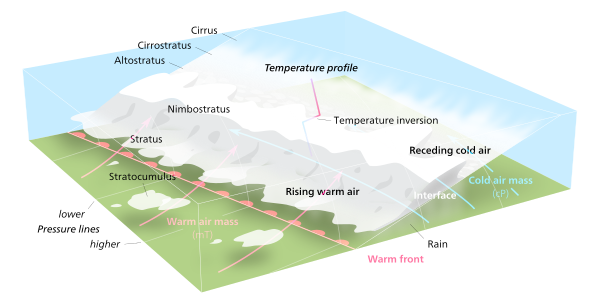
Warm front
If the warm air mass is unstable, thunderstorms may be embedded among the stratiform clouds ahead of the front, and after frontal passage thundershowers may continue.
On weather maps, the surface location of a warm front is marked with a red line of semicircles pointing in the direction of travel.
[2] A thickening and lowering of these high clouds into middle-stage altostratus or altocumulus is a good sign the warm front or low has moved closer and precipitation may begin within less than six hours.
If unstable altocumulus castellanus accompanies or takes the place of the main altostratus layer, cumulus congestus or cumulonimbus producing showers or thunderstorms may follow.
If the air mass is relatively stable, rainfall will increase until the front reaches the location, at which time the clouds can extend all the way to the earth’s surface as fog.
With its warm and humid characteristics, this air is susceptive to convective instability and can sustain thunderstorms, especially if lifted by the advancing cold front.